Skip to content
Vernier
Menu

One site visit.
Every measurement.

Vernier scans existing buildings with time of flight LiDAR and delivers a measurable 3D walkthrough, ANSI Z765-2021 floor plans, DWG exports, and structured room data. For architects, interior designers, and design build remodelers in New York, New Jersey, and Connecticut.

Loading walkthrough

Drag to look around. Click the floor to move. Use the ruler tool to measure anything. Open full screen

The site visit is the bottleneck

Every renovation starts the same way. Someone drives to the building with a laser and a pad, spends a day pacing rooms, drives back, and drafts a base plan from the notes. Then the drafting turns up the questions the notes did not answer, and someone drives back.

A scan replaces the day and the return trip. One visit captures every room and every opening, and the questions get answered from the walkthrough instead of from a second appointment with the homeowner.

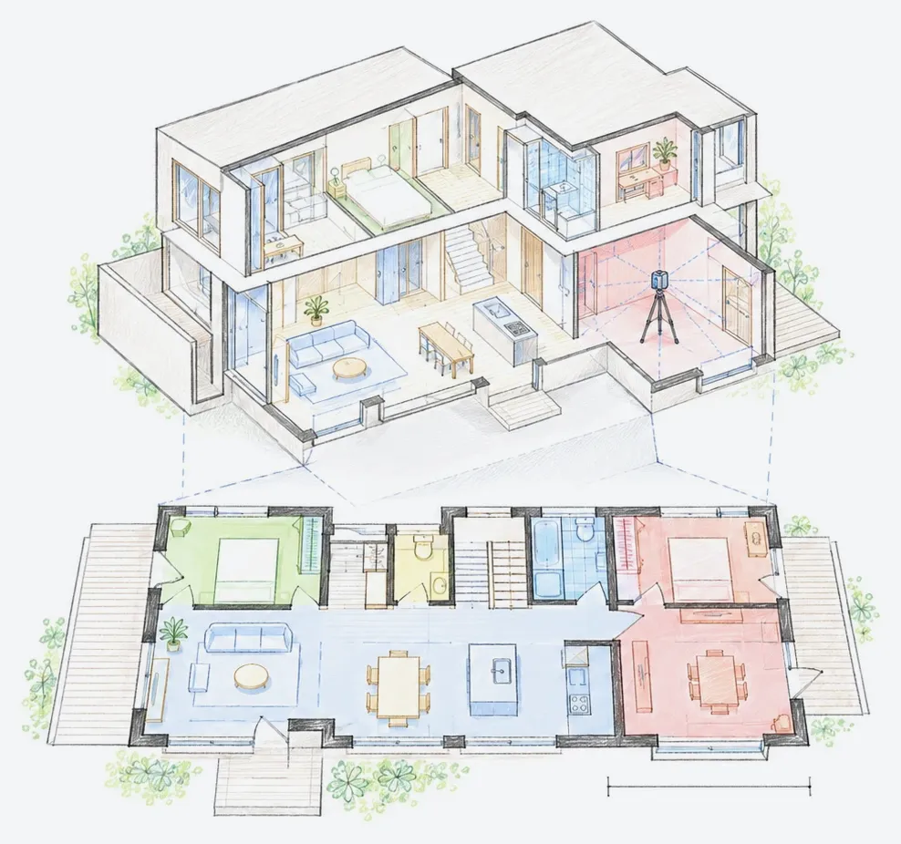
One floor, eight scan positions, overlapping coverage. Every room, every opening, one visit.

What you get

Everything below is in the capture package. Nothing is a tier.

  • 3D walkthrough

    Measure any distance in the browser. Share the link with the contractor and the client.

  • ANSI floor plans

    Every floor, with dimensions and room labels, to the residential measurement standard.

  • DWG export

    The measured geometry, ready to draft over in AutoCAD, Revit, or ArchiCAD.

  • Room and opening report

    Every room area and every door and window opening, as a CSV you can drop into a schedule.

  • 360 imagery

    High resolution panoramas at every scan position, for the details the plan does not show.

  • Add on drafting and 3D

    CAD drafted plans, a 3D model in Revit or DWG, the registered point cloud, elevations, and RCPs. See the 3D and Revit outputs.

Accuracy, stated

How the numbers are reached
Measurement uncertainty
10mm typically, camera to wall
Floor plan distance
0.5% or better
Square footage
1% or better
Standard
ANSI Z765-2021 residential measurement
Range
40m per scan position
Exports
DWG RVT SVG PDF ESX plus 360 imagery

How it works

  1. 01

    Send the address

    Address, rough square footage, and what you need back. A fixed quote comes back within a business day.

  2. 02

    One site visit

    Three to four hours for most houses. Time of flight LiDAR, 360 imagery, every room, every floor in scope, exterior if elevations are ordered.

  3. 03

    Processing

    The scan is registered, the floor plans drafted to ANSI Z765-2021, the room and opening report generated, the walkthrough published.

  4. 04

    Delivery

    A single link with the 3D walkthrough, floor plans, DWG, data report, and imagery. Drafted CAD and elevations follow on the drafting turnaround.

Models, not just plans

Three dimensional outputs, in the format your team actually opens.

What is in the model

01

Imagery

What it looks like

02

Point cloud

What was measured

03

Model

What you draft in

Three outputs from one scan. Revit RVT, 3D DWG, and the raw point cloud in DXF.

What it replaces

The scan is not competing with a cheaper scan. It is competing with a day of your own time and the trip back.

Measuring a mid size house by hand takes a competent person most of a day, plus travel, plus the hours to draft the base plan afterward. A second visit for the dimensions the notes missed is close to inevitable.

Hand measurements accumulate roughly an inch of tolerance per reading, and those errors compound across the hundreds of readings a single building takes. The industry puts inaccurate existing conditions data behind a meaningful share of all construction rework, and rework on a renovation is paid for at construction prices, not at drafting prices.

Put a number on your own day, add the return trip, then add one change order caused by a wall that was not where the drawing said. That is the comparison this is priced against.

  • 1 DAY

    To measure a mid size house by hand, plus travel

  • ~1 IN

    Tolerance a hand measurement accumulates per reading

  • 4 HOURS

    A scan on site, with nothing left to come back for

SAMPLE SET

Open the drawings before you order them

A complete set from a real project, in the formats you would receive. Open it in your own software and check the layers, the annotation, and the level of detail against what your office actually needs.

Drawn from a real project, with the address and client removed.

  • CAD floor plans, both floors (DWG)
  • Exterior elevations (DWG)
  • Plotted drawing set (PDF)
  • Registered point cloud (DXF)

SAMPLE_SET.url not set. Add the file to /public/downloads/ and point the config at it. Until then this block shows this notice instead of a dead button.

Pricing

Published rates. Price it yourself in thirty seconds.

Projects start at

$635

A flat day rate for the visit, plus a published per square foot rate for every deliverable. Nothing bundled, nothing hidden, and the registered point cloud is always free. Minimum project size is 1,500 square feet.

Build your estimate in the calculator

Recent projects

All projects

Send an address. Get a number back the same day.

Request a quote